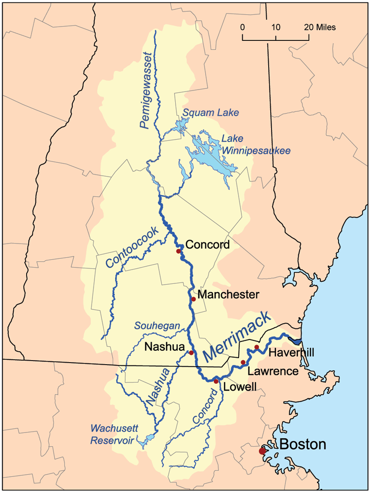
The Merrimack, or Sturgeon River, is formed by the confluence of the Pemigewasset, which rises near the Notch of the White Mountains, and the Winnipiseogee, which drains the lake of the same name, signifying “The Smile of the Great Spirit.” From their junction it runs south seventy-eight miles to Massachusetts, and thence east thirty-five miles to the sea. I have traced its stream from where it bubbles out of the rocks of the White Mountains above the clouds, to where it is lost amid the salt billows of the ocean on Plum Island beach.
Henry David Thoreau
Here we present a few images as a trailer for our video of the Merrimack River at the Amoskeag.
